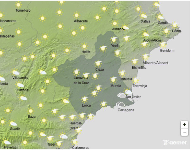
Spain’s weather agency (Aemet) has issued a yellow warning for snow in inland parts of Alicante this Monday.
Cold Arctic air is moving in, which will cause temperatures to drop sharply — by more than six degrees in many areas — with temperatures falling below freezing in some places.
Storm Francis will continue to bring rain throughout Monday. Combined with the colder air, this will lead to snowfall in inland and mountainous areas of Alicante, mainly from Monday evening (around 6 pm) through Tuesday morning, January 6. During this time, up to 2 centimetres of snow is expected.
According to Aemet, northern inland areas of Alicante have a good chance of snowfall, with 1 to 5 millimetres of precipitation, though the snow will be wet, so it is unlikely to build up very deeply.
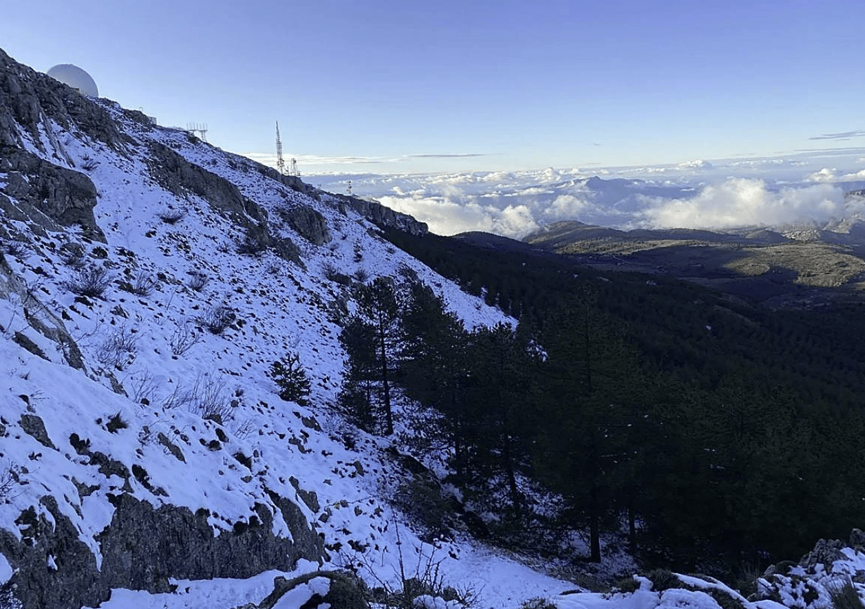
Monday, January 5, is expected to be the coldest day of this weather system. In some inland parts of the Valencian Community, up to 5 centimetres of snow could accumulate. The snow level will drop to 900 metres by Monday night and down to 600 metres by early Tuesday morning.
Aemet explains that heavier snowfall is less likely because of how the weather system is developing. Normally, the cold air arrives first and is followed by moist air, which produces heavier snow. This time, the cold air is arriving later, reducing the chances of more intense snowfall.
On Monday, the snow warning applies only to inland Alicante. However, on Tuesday, Aemet issued a cold weather warning of temperatures expected to be 6 to 8 degrees below normal, and lows possibly dropping to below –4°C in some areas.
Heavy Rain in Alicante
Rain will become heavier and more widespread throughout Monday, with the highest rainfall expected in the northern and inland areas of the province of Alicante.
In these areas, rainfall totals could exceed 100 litres per square metre, which is a large amount and could cause localised problems, especially in areas prone to flooding.
Snow in Alicante
One of the most important aspects of this storm will be the sharp drop in snow levels. Very cold air moving in will bring snow to some inland towns, particularly from Sunday onwards.
Snow levels could fall very low during Monday night and early Tuesday morning, although exact levels will depend on local conditions, making them hard to predict precisely.
A Complex Weather Situation, Especially at Sea
The Climatology Laboratory at the University of Alicante has described the situation as complex, noting that it is difficult to define a clear snow line. In storms like this, one valley may see snow while a nearby valley at the same height gets rain. For this reason, forecasts may continue to change as the storm develops.
The heaviest snowfall is expected in the inland mountain ranges, where colder temperatures and precipitation will combine more effectively.
Conditions at sea will also worsen significantly. Strong swells are expected, with waves of 2 to 3 metres, and some possibly exceeding 4 metres. Extreme caution is advised along the coast, particularly in exposed areas, ports, and seafront promenades. The storm is expected to ease during the early hours or morning of Tuesday, 3 Kings Day, although continued monitoring will be necessary until then.
WEATHER IN MURCIA
Monday, January 5
Monday is expected to be a wet and unsettled day across the region. While the storm will be less intense than on Sunday, steady and occasionally heavy rain will continue, especially along the coast. Rain will spread across the entire region during the morning, with yellow warnings remaining in place for Campo de Cartagena and Mazarrón until 10am.
Skies will stay mostly cloudy, and rough sea conditions are expected along the coast. Snow levels will fall sharply, reaching 700–800 metres in the northwest by the evening. Temperatures will drop noticeably and are unlikely to reach 10°C, even at the warmest point of the day.
Tuesday, January 6
Rain from overnight will persist into the early hours, but conditions should improve by midday, with skies clearing and sunny spells developing during the afternoon. All weather warnings will be lifted, although snow will continue to fall in some inland areas.
Daytime temperatures will remain similar to Monday’s, but Tuesday night will be much colder, with lows ranging from -3°C to 5°C.