Orihuela City Council is taking part in a new project to monitor the subsoil beneath the city’s historic centre, in a preventive move aimed at protecting both heritage buildings and private properties from possible ground movement.
The initiative is being carried out by the Department of Historical Heritage, led by councillor Matías Ruiz, in collaboration with the Projects and Works Department of the Segura Hydrographic Confederation, CHS.
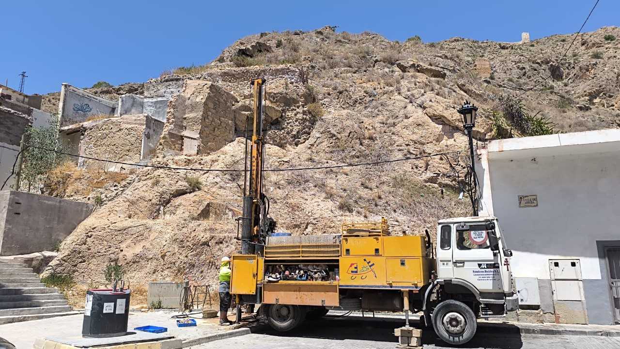
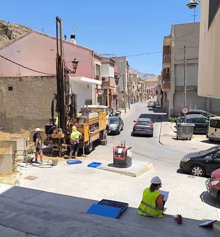
The project will involve the installation of extensometers and piezometers at various points in the historic centre and surrounding areas. These instruments are used in geotechnical and structural monitoring. Extensometers measure deformation, displacement or stretching in soil, rock and structures, while piezometers record underground water pressure and changes in the water table.
The aim is to obtain accurate data on how the ground behaves, particularly during periods of drought. When necessary, the CHS may authorise the extraction of water from reserve wells. Such extractions can lower the water table, potentially causing ground settlement as underground water pockets dry out. This can pose a risk to historic buildings and other properties in the urban area.
The project includes a network of control points, strategically distributed through boreholes in the subsoil. Some devices will be located within the urban area, while others will be placed close to water extraction points. Those installed in the historic centre will be used to detect possible ground movement and monitor any impact on buildings.
The work is considered particularly important because of Orihuela’s geological characteristics. Much of the historic centre sits on Plio-Quaternary alluvial fan sediments and colluvial deposits, materials considered less vulnerable to settlement. However, more modern parts of the city stand on the alluvial plain, where thick layers of sandy and silty sediments may consolidate when underground water pressure falls. These areas could therefore be more affected by a drop in the water table.
Orihuela has previously recorded settlement problems linked to changes in the water table following works to channel the River Segura. These effects have been observed especially in historic buildings with shallower foundations, including properties in Plaza Nueva and Calle San Agustín.
To ensure accurate measurements, the extensometers will use topographical reference bases installed in stable areas, near the slope of the sierra and on rock outcrops not affected by ground movement. The control points will be protected at surface level by circular metal plates measuring approximately 15 centimetres in diameter, allowing reliable periodic measurements.
From a heritage perspective, the intervention is expected to have minimal impact on the subsoil. The locations have been selected by municipal archaeologist Silvia Yus, from the Historical Heritage Service. Archaeological monitoring will also be carried out throughout the works as a precautionary measure.
The boreholes and stratigraphic studies are expected to provide valuable scientific information about the composition and historical evolution of Orihuela’s subsoil. The data could help determine sediment depth in different areas, identify alluvial and colluvial deposits, locate possible structural remains or built levels, establish the depth of sediments altered by human activity, recover archaeological material that may help date different layers, identify bedrock, and determine the precise level of the water table.
Ruiz said the project represented “an important tool for protecting our historical heritage through prevention.”
“Thanks to the information provided by the extensometers and piezometers, we will be able to better understand the behaviour of the subsoil, anticipate possible effects and make informed decisions to preserve our historic buildings and the heritage of all Oriolanos,” he said.
He added that the project also had significant scientific and archaeological value, as monitoring the works would expand knowledge of the evolution of Orihuela’s subsoil and provide important data on the city’s geology and historical occupation.
“This is an initiative that combines research, conservation and preventive protection of cultural heritage, which are priority objectives for this department,” Ruiz said.
The councillor concluded that cooperation between public administrations showed that heritage protection also depends on understanding the territory and planning ahead.
“The more information we have about the behaviour of the subsoil, the better decisions we can make to guarantee the conservation of one of the most important historic centres in the Valencian Community,” he said.