Playa Flamenca project occupies 11,000 m² near Cañada de la Mosca despite EU flood-risk warnings
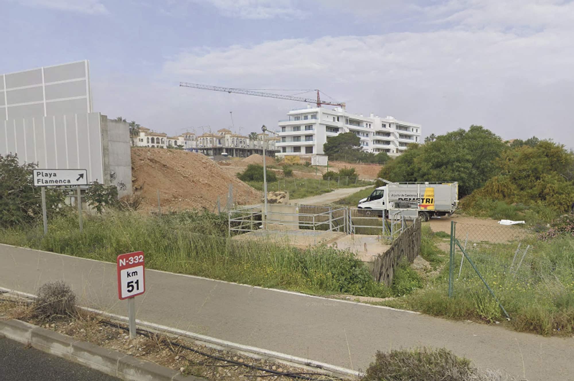
A new tourist housing development in Playa Flamenca has taken over 11,000 square meters of land in the natural valley of the Cañada de la Mosca and Toro ravines, dramatically reducing the drainage capacity of one of Orihuela Costa’s most fragile waterways.
Although the project holds all the required municipal and regional permits, it narrowly skirts the geomorphological risk zones established in 2015 by the Territorial Action Plan against Flood Risk (Patricova). The plans, based on the outdated 1990 General Urban Development Plan, have allowed construction to proceed despite growing evidence of climate vulnerability on the Mediterranean coast.
A Funnel for Floodwaters
Urban planners and environmental experts warn that by raising the ground level with massive earth fills and narrowing the natural valley, the development creates a dangerous funnel effect. While the new homes themselves are unlikely to flood, the water that once spread through a broad ravine will now be forced downstream into narrower sections, heightening the risk of flash floods in Playa Flamenca and at La Mosca beach.
That beach has already shown signs of fragility: last July, after just 40 litres per square metre of rainfall, stormwaters damaged restrooms and lifeguard huts, forcing a two-day closure.
From Natural Ravine to Concrete Embankments
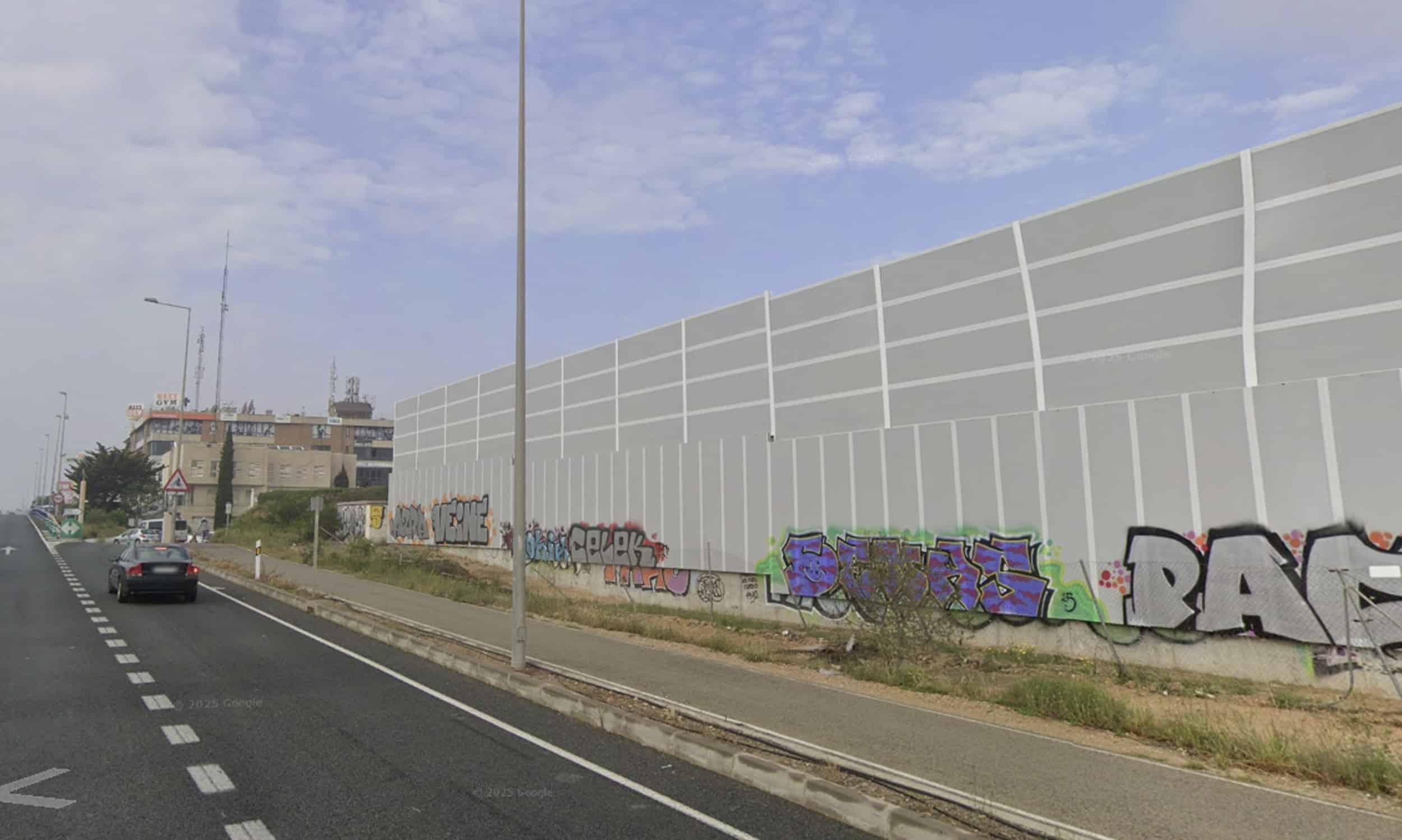
To make room for the two residential blocks, developers built an artificial slope several metres high to level the terrain with the street, essentially walling off part of the ravine. A large acoustic barrier has also been erected along the N-332 highway, though already vandalized, leaving residents facing a concrete wall instead of the natural landscape.

The ravine itself runs for just over two kilometres to the sea, but decades of unplanned development have already eroded its natural function. In the 1990s, housing projects near Los Dolses consumed large sections of the valley. Now, with this new project, yet another section of Orihuela’s coastline loses its natural drainage and ecological buffer.
Recurring Pattern of Environmental Neglect
This is not an isolated case. In La Cuerda, another residential project has filled the slopes of the Cañada de la Posposa ravine, destabilizing its outlet at Cala Bosque (La Zenia beach). Across Orihuela Costa, similar practices—occupying ravine slopes without officially invading public land—have repeatedly narrowed natural waterways.
The consequences are already visible in silted channels, recurring storm damage, and chronic sewage overflows from pumping stations unable to cope with summer demand.
Despite repeated problems, none of the ravines along Orihuela Costa—from the Rio Nacimiento in Campoamor to the Cañada Hermosa—have been properly demarcated by the Segura River Hydrographic Confederation. This absence of clear protection has allowed thousands of homes to be built in sensitive zones, undermining both public safety and environmental resilience.
Short-Term Profits, Long-Term Risks
While Orihuela City Council insists the Playa Flamenca project is legal and respects planning rules, critics argue that relying on outdated planning tools while ignoring flood-risk warnings is reckless in the face of climate change.
Each new development may bring immediate economic gains, but cumulatively they erode natural defenses, turning ravines into urbanized choke points that can no longer absorb or channel stormwater.
For Orihuela’s coastline—already plagued by sewage spills, beach closures, and storm damage—the latest project is yet another step in prioritizing concrete over climate resilience.