The recent death of a 28 year old Columbian National has focused the years of neglect, failed planning and unresolved legal battles on one of the most isolated stretches of the Orihuela Costa shoreline.
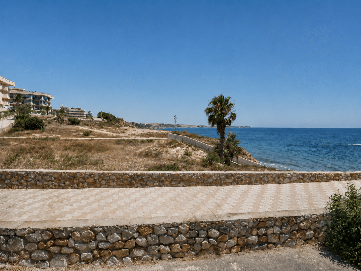
The coastal strip south of Barranco Rubio, between Campoamor and Mil Palmeras, remains cut off from the rest of Orihuela Costa, with no proper road connection, poor pedestrian access and an unsafe cliffside path that has been left largely unmaintained.
The area is one of the clearest examples of the long-term damage caused by speculative development before Spain’s 1988 Coastal Law came into force. Apartment blocks were built or planned along the seafront during the real estate boom of the mid-1980s, but later faced demolition orders after falling foul of coastal protection rules.
The result is a fragmented and neglected landscape: demolished buildings, unfinished planning, isolated residential areas and a dangerous pedestrian route running beside the cliffs.
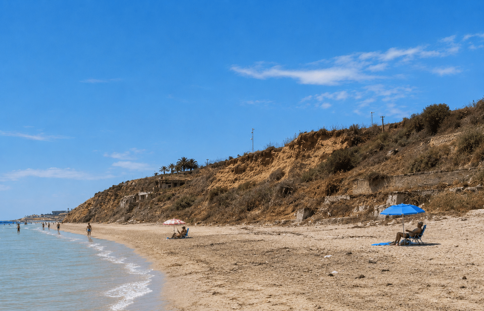
In March, a young man died after falling while walking with his partner along the cliff path. In parts of the route, only a low wall of around half a metre separates pedestrians from the drop below. In other sections, there is no real protection at all. On the beach below, a sign warns of landslides.
While most of Orihuela Costa’s coastline is linked by promenades and pedestrian paths between Punta Prima and Campoamor, this section of Mil Palmeras remains the major exception. Elsewhere, even where access is difficult or encroached on, pedestrians can usually continue along the shore. Here, the route is broken, unsafe and poorly connected.
The lack of planning is also reflected in road access. To reach this part of Orihuela, drivers and pedestrians must enter through Pilar de la Horadada from the N-332 roundabout. There is no internal road connection from Campoamor through Orihuela municipality to this coastal sector. When the fatal accident occurred, the first local police officers to respond were from Pilar de la Horadada.
The planning problems date back decades. Orihuela’s 1990 General Plan envisaged this part of the coast as a continuous urban front, even though Pilar de la Horadada had already separated from Orihuela as an independent municipality. Since then, the southern edge of Orihuela Costa has remained marked by disconnection and neglect.
Pilar de la Horadada once faced similar problems on its side of Mil Palmeras, including demolition orders, unfinished buildings, legal disputes and compensation claims from developers after licences were granted for projects later blocked by the Coastal Law. However, more than a decade ago, Pilar resolved much of the issue through demolitions, coastal improvements, green areas, parking facilities and an agreement allowing the developer to build more homes on the second line.
On the Orihuela side, by contrast, the picture remains unresolved. The area includes a closed commercial zone, second-line residential development, plots where apartment blocks were demolished after a long legal battle, five buildings that narrowly escaped demolition, and a solitary aparthotel built by the same developer who tried to move ahead before the Coastal Law came into effect.
Only two streets in the area have names: Avenida de Francia and Calle Palmera Canaria.
The strip is bounded by the Barranco Rubio ravine to the north and the Cañada de Matamoros ravine to the south. Ironically, because the area was never fully developed, both ravines still retain areas of Mediterranean woodland along their banks.
A development plan known as R1-B has been on the table for years and would allow at least 800 homes to be built on the remaining undeveloped land. Supporters argue that only full urban development will finally bring proper infrastructure and improvements to the area.
For now, however, Mil Palmeras remains one of the most abandoned stretches of Orihuela Costa: isolated, poorly maintained and still paying the price for decades of failed planning.


")